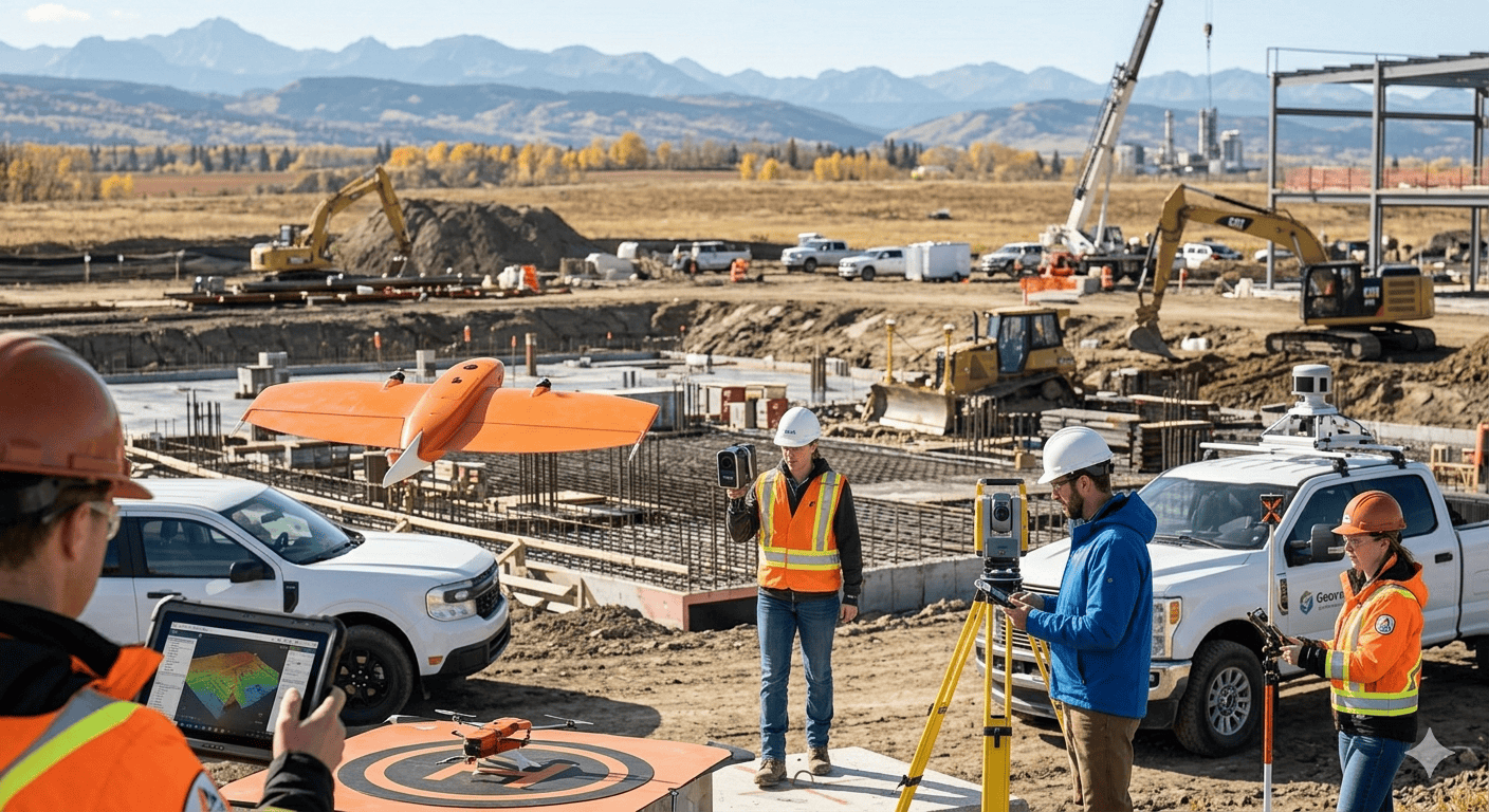
The “Total Station” on a tripod has been the symbol of surveying for decades. But as construction speeds up, the industry is looking for alternatives that provide more data in less time. If you find that waiting for a surveyor is slowing down your earthworks or foundation team, it might be time to look at these high-tech alternatives.
The Rise of UAV Photogrammetry
Drones (UAVs) have revolutionized site mapping. Instead of a surveyor walking a grid every 50 feet, a drone flies a programmed path and captures high-resolution imagery.
The Benefit: You get a full 3D “Digital Twin” of your site.
The Use Case: This is the best alternative for calculating “cut and fill” volumes. If you need to know exactly how much dirt was moved this week to pay a subcontractor, a drone survey is faster and more accurate than any manual method.
Mobile Mapping and Terrestrial LiDAR
If you are working on a road, bridge, or a busy urban site, “Mobile Mapping” is the premier alternative. This involves mounting a laser scanner (LiDAR) onto a vehicle. As the vehicle drives at normal speeds, the scanner captures millions of points per second, creating a high-definition “point cloud” of the environment.
Why it works: It eliminates the need for “lane closures” or putting workers in the middle of a live road. It’s safer, faster, and provides a level of detail that covers every crack in the pavement and every overhead wire.
Robotic Total Stations (RTS) for Self-Sufficient Crews
Some contractors are moving “in-house” by using Robotic Total Stations. Unlike a traditional station that requires two people (one at the camera, one with the rod), an RTS can be operated by a single person using a tablet.
The Shift: This allows a site foreman to do their own daily layouts and check grades without waiting for an external surveying firm to show up. While it requires an upfront investment, it offers a massive boost to site independence.
Recent Posts
The Financial Blueprint: How to Budget for Site Surveying Services
Everything in construction costs money, and trying to plan out those expenses can feel like trying to guess the price of a massive, real-life LEGO set. When you are building something big, like a new...
Why GPS Needs a "Snapchat Timer": Understanding Correction Age
Ever Wondered How Your Phone Actually Knows Exactly Where You Are? Imagine you are playing a mobile game like Pokémon GO, or using Google Maps to find a new skatepark. Your phone uses GNSS to figure...