Ever Wondered How Your Phone Actually Knows Exactly Where You Are?
Imagine you are playing a mobile game like Pokémon GO, or using Google Maps to find a new skatepark. Your phone uses GNSS to figure out your location. Usually, it’s accurate within a few meters.
But what if you are a surveyor mapping a new building, or an engineer programming a machine control dozer or grader? A few meters of error could mean wrongly grading ditch. They need centimeter-level accuracy.
To get that insane level of precision, GNSS receivers use a trick called corrections. And to make those corrections work, they have to watch something called the Correction Age.
Here is a breakdown of what that means, completely jargon-free.
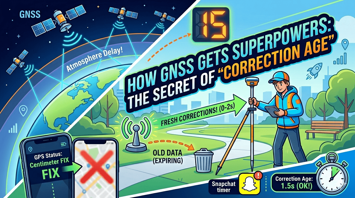
The Problem: GPS Has Bad Days (Atmospheric Drama)
GNSS satellites are floating out in space, beaming signals down to Earth. But before that signal hits your phone, it has to blast through miles of the Earth’s atmosphere.
The atmosphere is filled with clouds, electricity, and gasses that bend and slow down the GPS signal. It’s like trying to run through a swimming pool—it slows you down. This causes minor timing glitches, which makes your GPS location drift.
The Solution: The “Cheat Code” Station
To fix this, professionals use a two-receiver system called RTK:
The Base Station: A GNSS receiver is glued to a fixed, known spot on the ground. Because it knows exactly where it is, it can instantly spot when the satellite signals are tripping. It calculates the error and says, “Hey, the atmosphere is slowing the signal down by 0.00003 seconds right now.”
The Corrections: The Base Station broadcasts the “answers” to fix the error over the internet or radio waves.
The Rover: Your moving receiver (on a drone, tractor, or survey pole) grabs those answers and instantly corrects its own position. Boom—centimeter accuracy.
Enter: The “Correction Age” (The Expiration Date)
Here is the catch: The atmosphere is constantly changing. It’s shifting, heating up, and cooling down.
Because it takes time for the Base Station to calculate the fix, beam it into space or over the cell network, and for your receiver to download it, there is always a tiny delay.
Correction Age is simply the age of that fix-it data. > Think of it like Snapchat. If a friend sends you a snap of a traffic jam right now, it’s super useful. If you open that snap 3 hours later, the traffic is gone. The data is too old.
In the GNSS world:
0 to 2 seconds old: Perfect. The data is fresh. Your GNSS is dead-accurate.
5 to 10 seconds old: Getting sketchy. The atmosphere has already changed a bit. Your accuracy starts to drift.
30+ seconds old: Expired. The data is useless. The receiver will actually throw it in the trash because using old data would just mess up your location even more.
Why does the Age spike?
If a surveyor is out in the field and notices their “Correction Age” is climbing to 10, 15, or 20 seconds, it usually means one thing: Bad Wi-Fi or Cell Service. It means the moving receiver isn’t getting the text messages from the Base Station fast enough. The moment the cell signal drops, the Correction Age ticks up, and the GNSS loses its super-powers until the connection comes back.
Written in collaboration with AI and grounded in the real-world engineering standards used by modern surveyors and drone pilots, this guide cuts through the heavy math to give you the exact facts.
Recent Posts
The Financial Blueprint: How to Budget for Site Surveying Services
Everything in construction costs money, and trying to plan out those expenses can feel like trying to guess the price of a massive, real-life LEGO set. When you are building something big, like a new...
Beyond the Total Station Exploring Modern Alternatives to Traditional Surveying
The "Total Station" on a tripod has been the symbol of surveying for decades. But as construction speeds up, the industry is looking for alternatives that provide more data in less time. If you find...